
First off, I have to thank my friend LC for putting this amazing guide together. This saved me so much time and made the trip so easy with SGDF. I didn’t make too many changes to LC’s original list driving down from SF to LA, but added some of our observations and photos.
General Tips:
- Take a gas efficient car: It was my first time making the drive and I was thankful I rented a small car. There are so many narrow, winding roads and hills that ate into our gas.
- Take your time: There are so many great attractions and vista points along the drives.
- Housing: I would stay either North or South of Big Sur since there aren’t many places to stay in Big Sur. SGDF and I stayed in Cambia, an hour south of Big Sur.
- Pack snacks and water: It might be miles before you see a place to grab some food.
- Book the following ahead of time: Hearst Castle, Point Sur Lighthouse Station (if you want to do the Lighthouse tour), and Esalen Hot Springs (if you want to use the baths from 1-3AM)
DAY 1
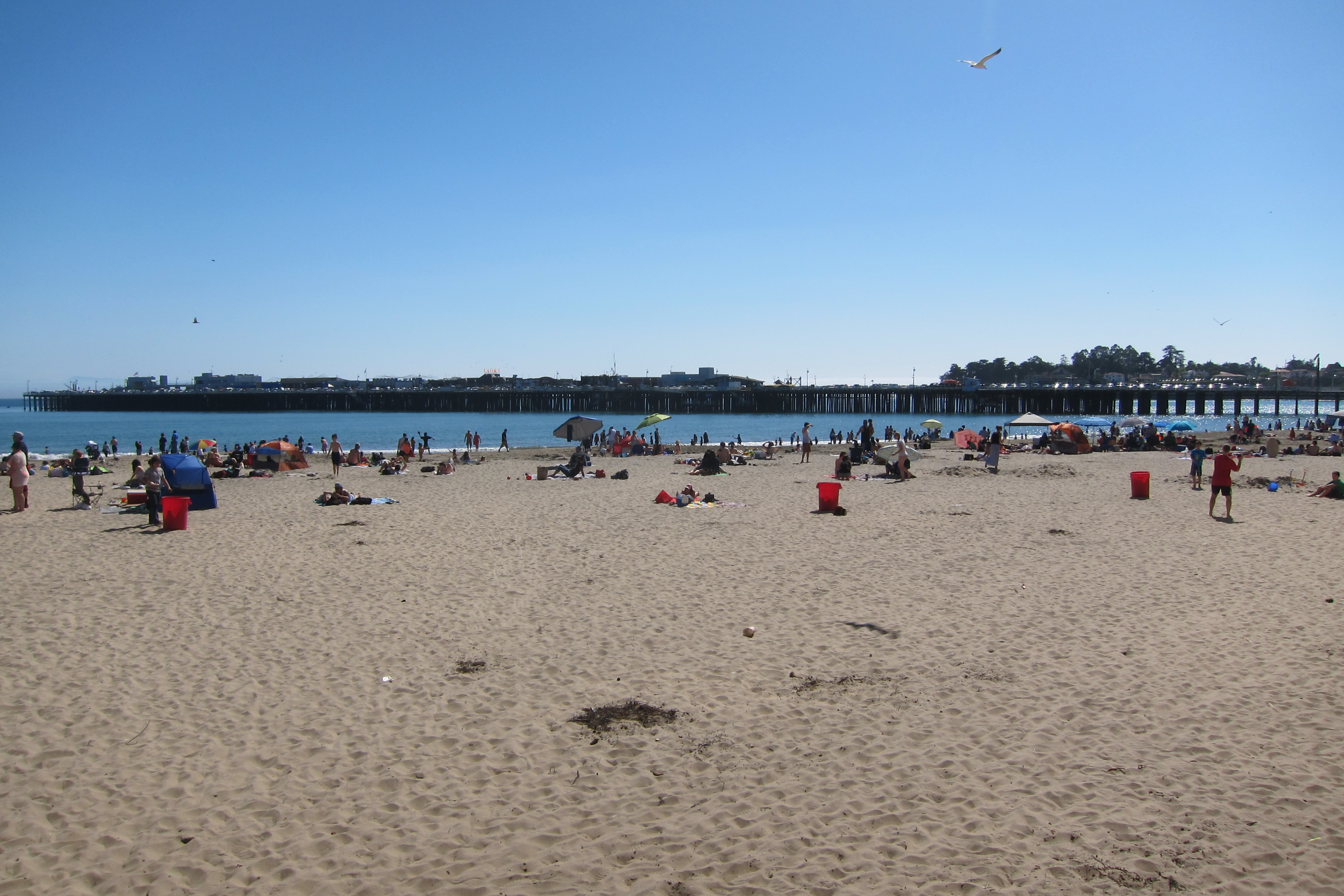
Morning: Stop by Half Moon Bay, south of San Francisco and known for the beaches and seafood. Just note that it will most likely not be warm (maybe in September or October during SF’s Indian summer). Head down to Pigeon Point Lighthouse (LC says it is a 20 min stop), a small, quiet spot to rest and enjoy breathtaking views. It is nice because you don’t have to book a tour to just wander around on your own. Drive past San Jose to Santa Cruz, known for their beach (usually cloudy, but if you catch it on a good day, it is pretty darn nice) and their Boardwalk, where you can get carnival food, play arcade games, or ride the rollercoasters.
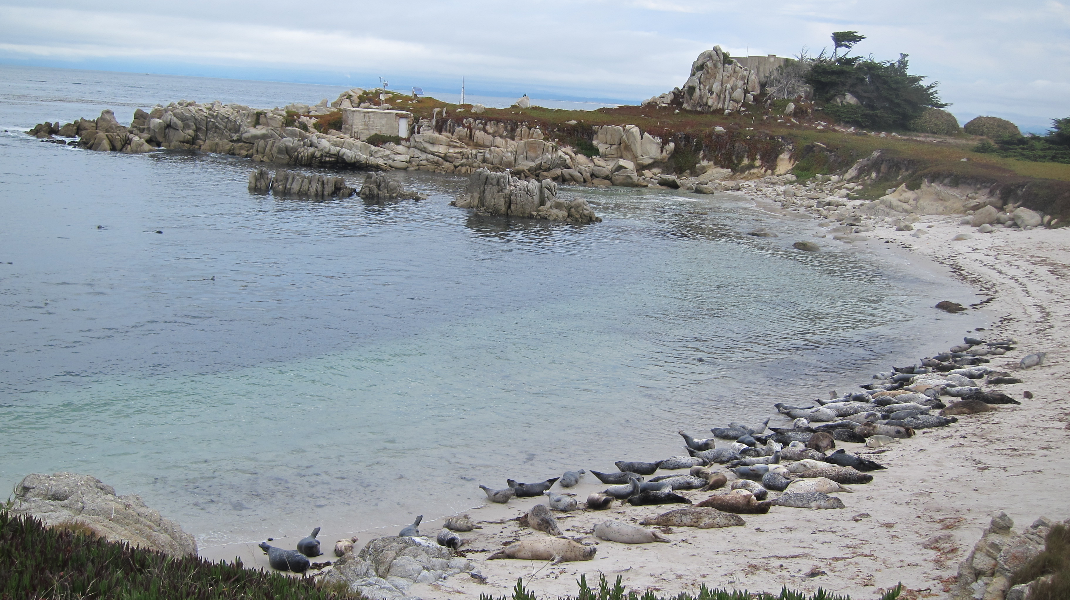
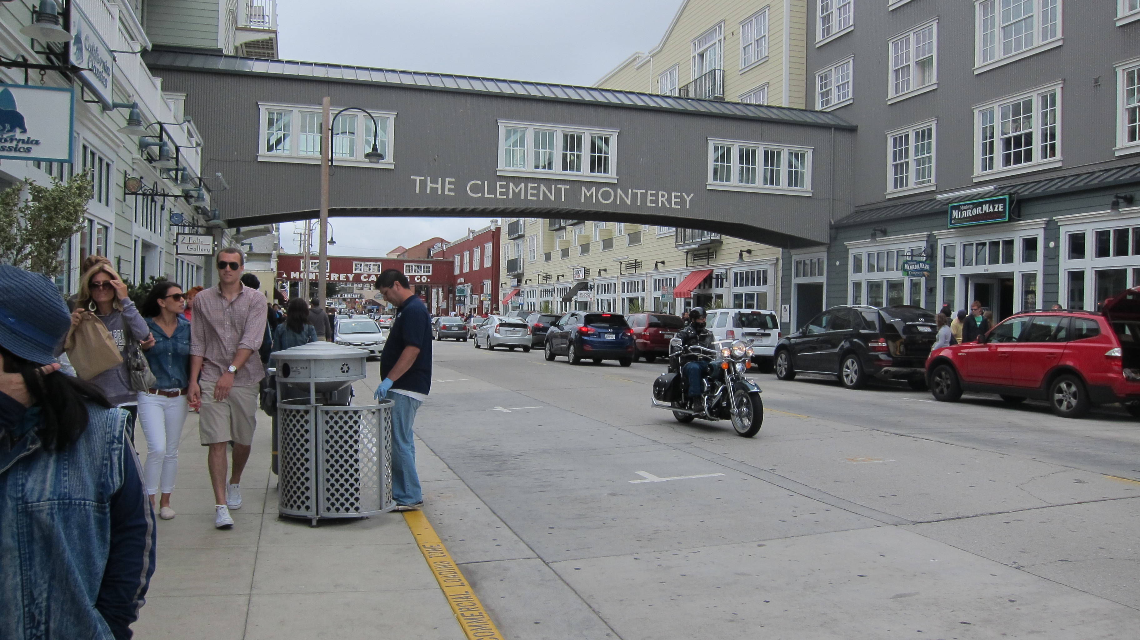
Afternoon: As a kid, I loved Monterey because of the aquarium and delicious clam chowder so I would make a stop here. Wander around Cannery Row and take photos, look at some shops, or eat at one of the many dining options. Cannery Row reminds me of SF’s Fisherman’s Wharf but SF doesn’t have the Monterey Bay Aquarium.
Lunch: Walk down and grab some lunch at a place called Fisherman’s Wharf, they have fresh seafoods and great clam chowder. You can do a to-go order and eat on the steps of the Custom House.
Post lunch: Some other attractions include: Royal Presidio Chapel, Monterey State Historic Park, Casa Soberanes, and Larkin House. Feel free to kayak to work off lunch and potentially see some sea otters or sea lions.
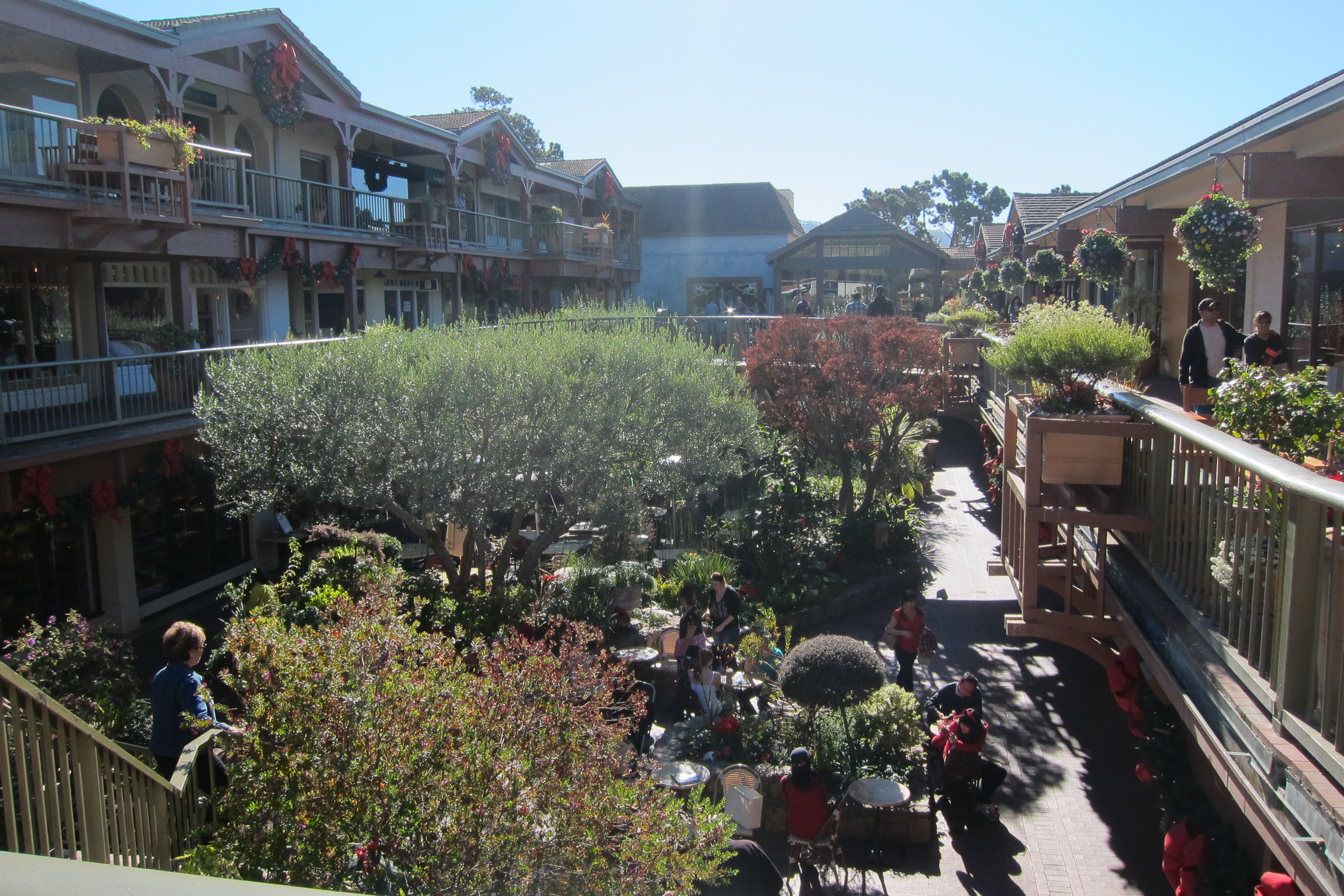
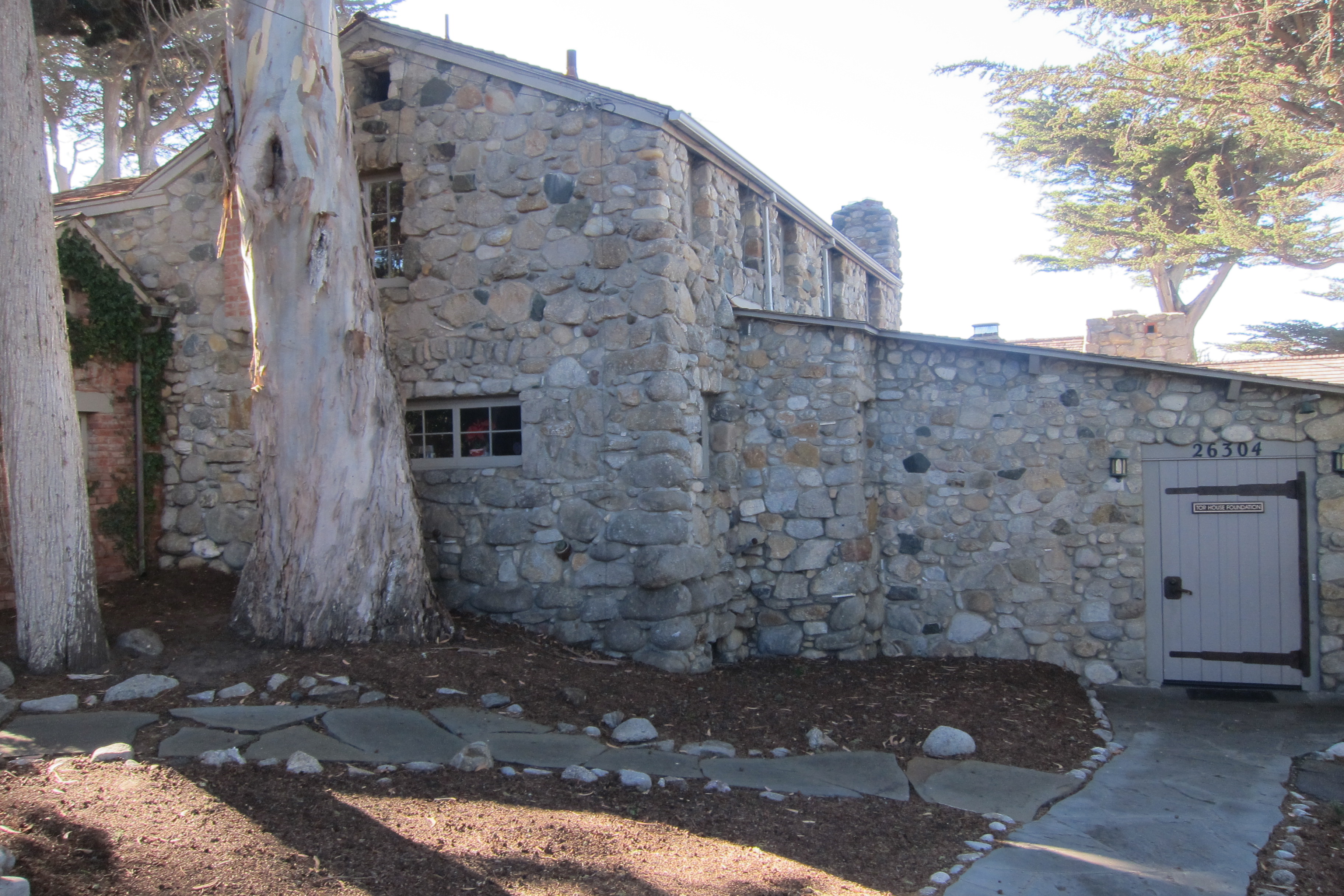
Evening: I wish I spent one night in Carmel-by-the-Sea, a pretty beach town where you can explore the boutiques and high end stores, do some wine tastings, and see some of the sights like Tor House (5 mins), the house of poet Robinson Jeffers, and Mission San Carlos Borroméo del Río Carmelo (25 mins), one of the California missions.
DAY 2
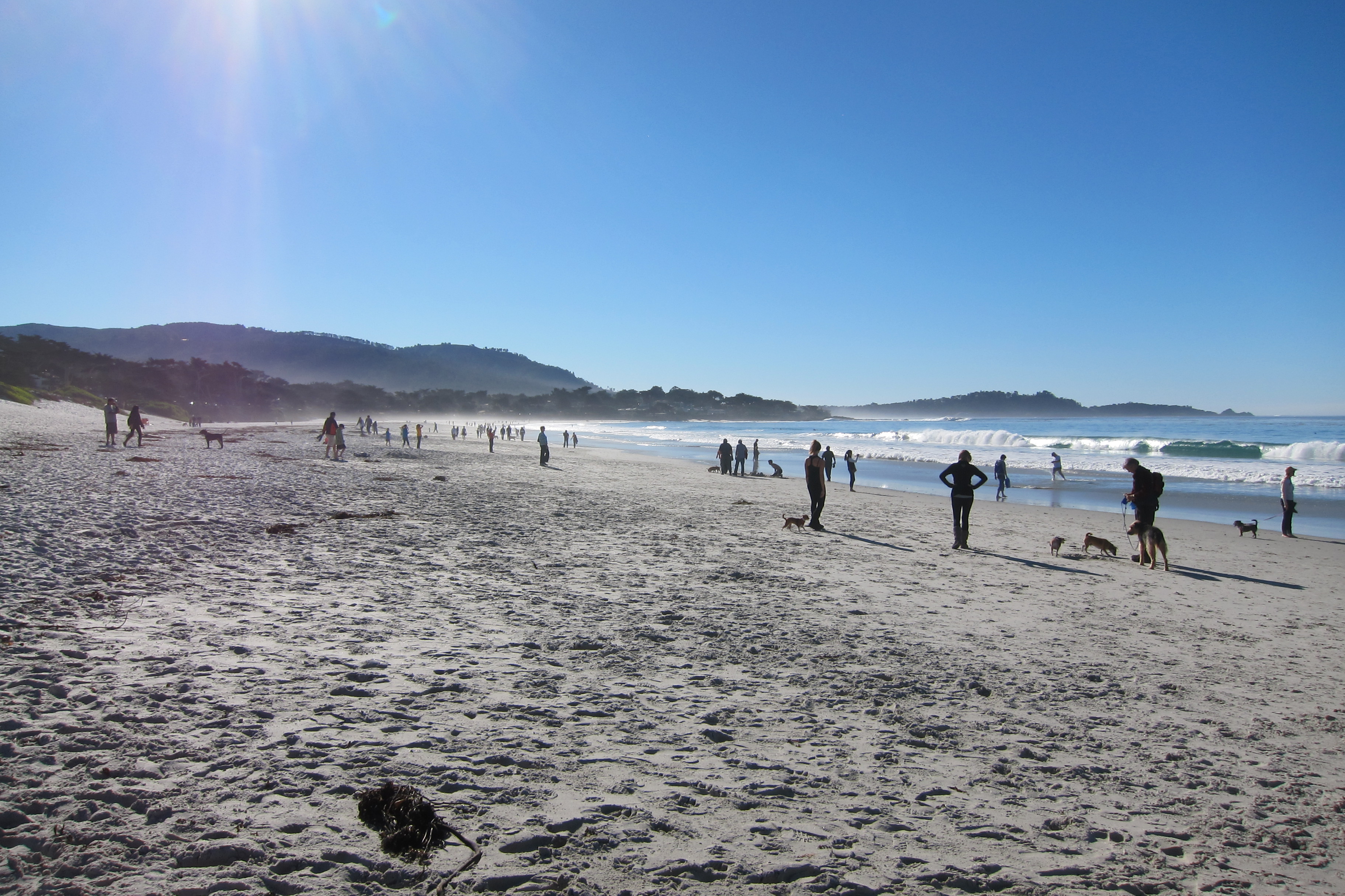
Morning: Head over and check out Carmel River State Beach, where you can spot some pelicans and kingfishers.
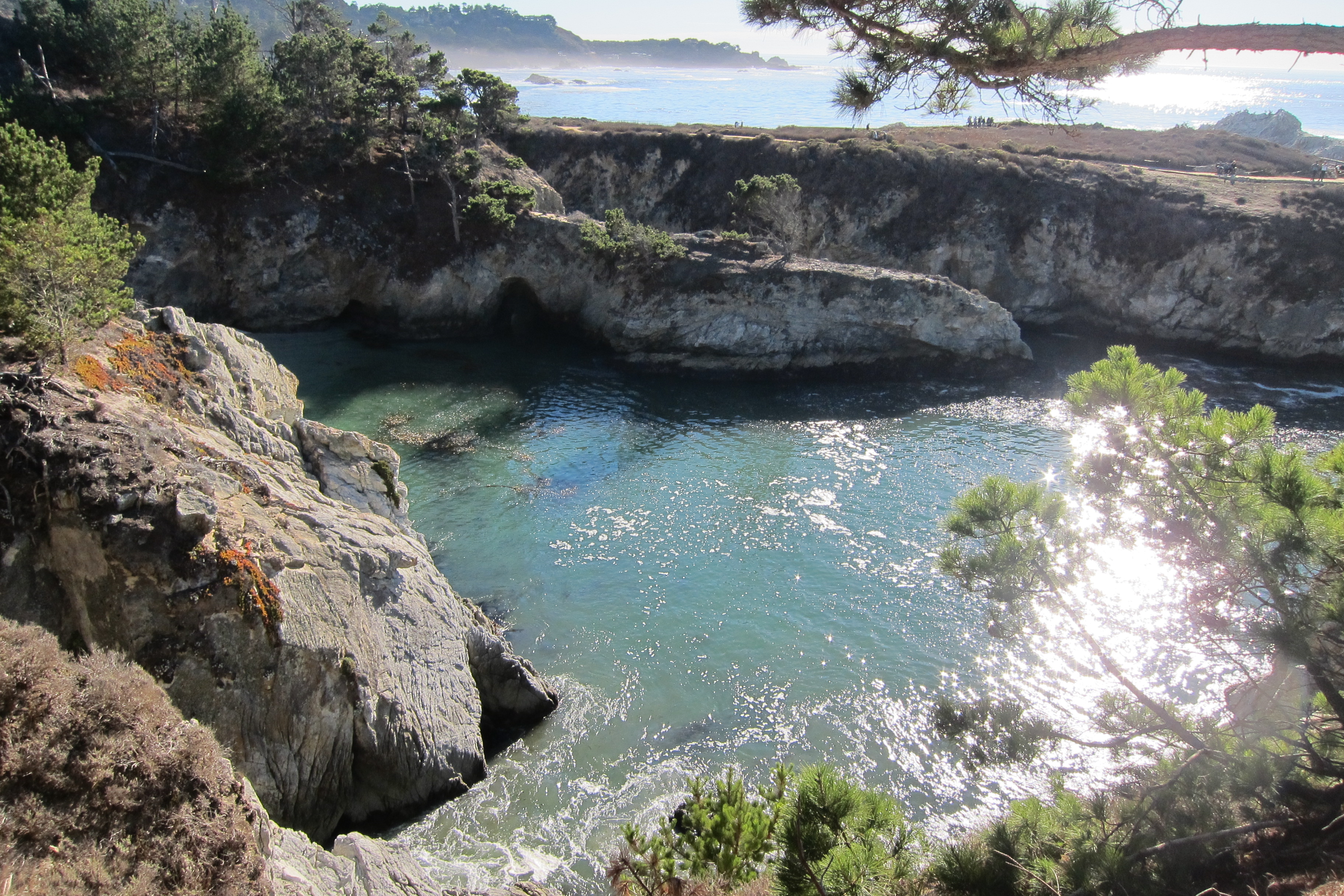
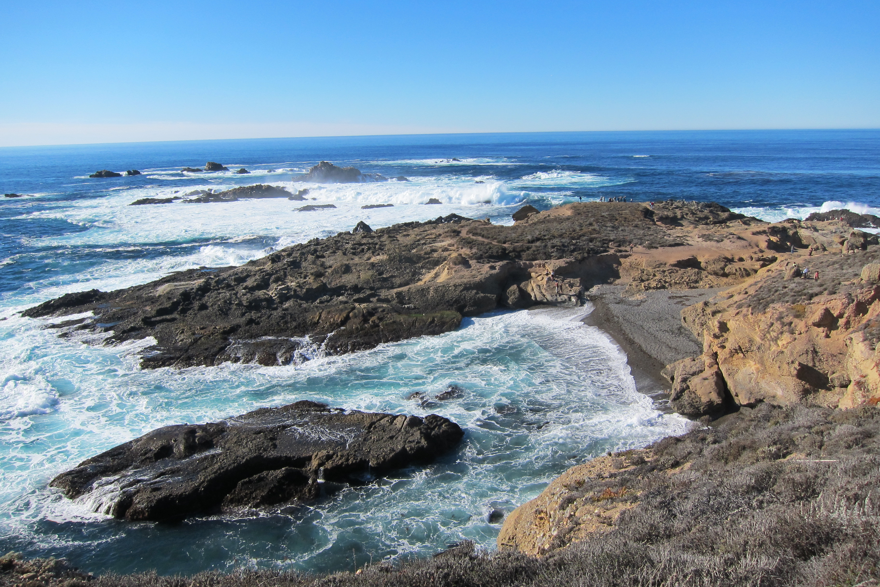
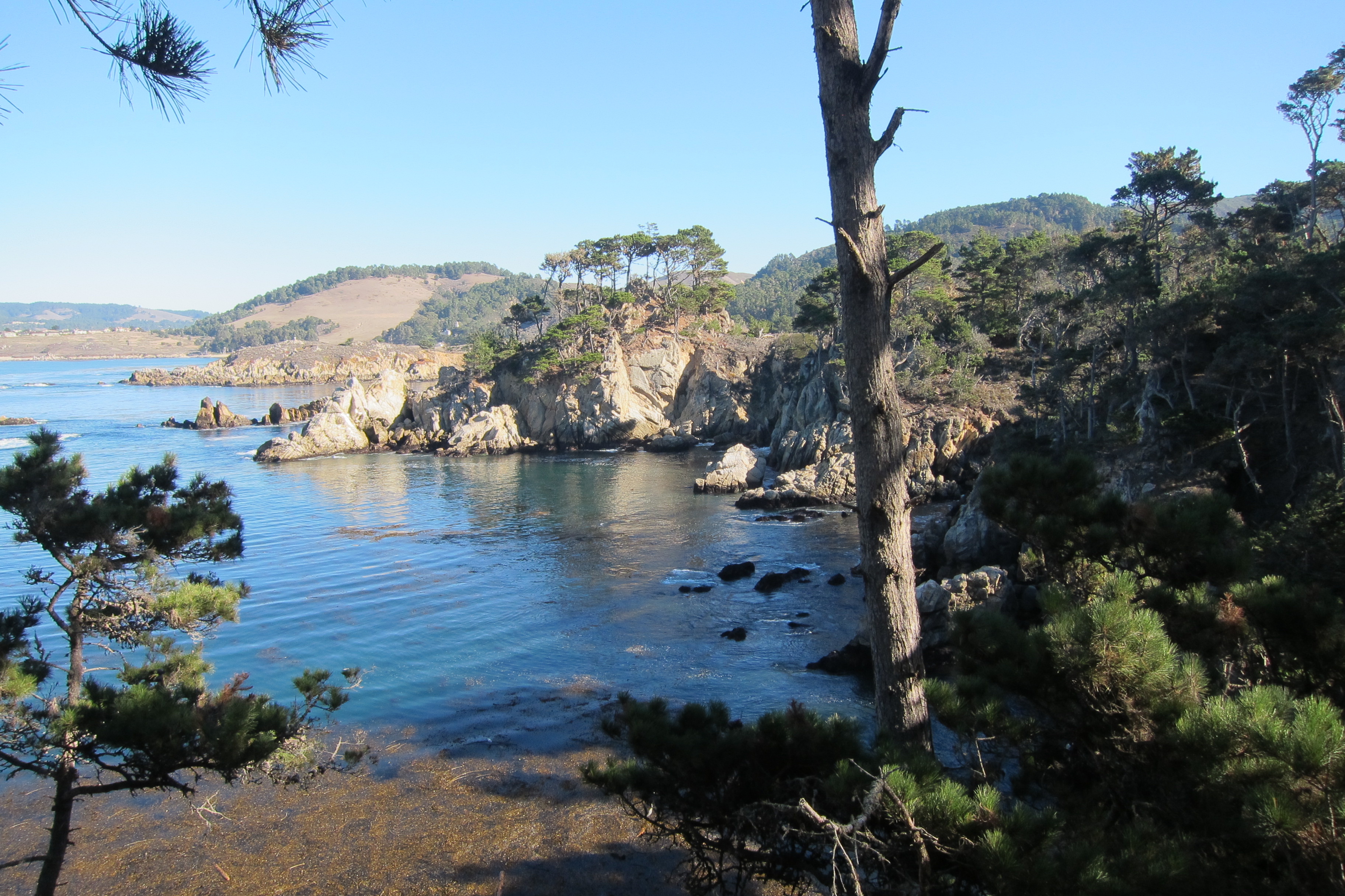
Drive down to Point Lobos State Reserve for a hike (4 hours). Tip: This place is open 8AM to ½ hour after sunset and there is $10 parking on site, but you can park elsewhere and walk in and provide a $1-2 donation. This was my favorite hiking area because of the beautiful views, beachside walks, and various trails based on level and distance (trail map link here).
Some other fun things you can do here include:
- China Cove (closed as of Nov 2013 but should be reopening soon, small beach)
- Gibson Beach (also a small beach)
- Whale watching (migrating gray whales from Dec – April)
- Tide pools
- US’s first undersea ecological reserve
- Kelp forests
- Scuba, kayaking, snorkeling, paddle boarding, and free diving (reservations in advance recommended)
- Picnicking
You can also hike at Garrapata State Park, 2 miles of beach front and great coastal hiking.
Afternoon: Hit the road again and drive past Bixby Creek Bridge. I would stop before the bride to snap a photo of this famous bridge. Tip: I didn’t take this route, but LC mentioned you can take the Old Coast Road, which goes from Bixby Bridge to Andrew Molera and has amazing views. It is about 10ish miles (an hour to drive), but can be tough to drive due to the blind turns and one lane.
If you love sea otters, stop by California Sea Otter Game Refuge. Drive further south and stop by Point Sur State Park and Lighthouse Station. Unfortunately the hours are inconvenient and you have to book a tour group to explore the grounds (tour is 3 hours).
For an afternoon hike, there are two options, 1) Andrew Molera State Park or 2) Pfeiffer Big Sur State Park. Andrew Molera State Park has some of the following:
- Camping: 24 available camp sites, reservations required
- Cooper Cabin: oldest structure in Big Sur
- Highbridge Falls: Year round waterfall, short and easy hike
- Hiking (some trails below, you can ask a park ranger for best options):
- Creamery Meadow to Molera Beach: Easy, 2 miles round-trip. A stroll through Creamery Meadow to a driftwood covered Molera beach.
- Molera 8-mile loop: Moderate to Hard, 8 miles round-trip. A combination of the Ridge Trail, the Panorama Trail and the Bluffs Trail with great coastal views and beach access.
- Many of the trails at Andrew Molera have mountain bike access.
- Hoseback Riding: Molera Horseback Tours
- Directly across Highway 1 from Andrew Molera is the entrance to the Old Coast Road, which is also good for mountain bike riding.
- Ventana Wildlife Society’s Discovery Center: Open Saturdays and Sundays from Memorial Day through Labor Day, (10 am – 4 pm) including holidays. Exhibits about condors and birds and there are onsite tours.
Pfeiffer Big Sur State Park: (not to be confused with Julia Pfeiffer Burns State Park): Opened ½ hour before sunset to ½ hour after sunset. Easy to get in to park and I think parking was $10 for the day. It is a beautiful park to just walk around or hike, but there are some better parks so it could be missed. Here are some attractions:
- Camping
- Big Sur Lodge: If you’re looking for somewhere fun to stay hotel wise and in Big Sur, it is right in the middle of the park. Also convenient to grab a hot cocoa or coffee.
- Pfeiffer Beach: rock formations, cliffs, sand dunes, and a shallow lagoon. The beach is two miles off the main road down Sycamore Canyon Road, south of the main park entrance, marked only by a sign saying “Narrow Road.”
- Hiking (some trails below, you can ask a park ranger for the best ones or a map):
- Pfeiffer Falls: Easy, 1.4 miles round-trip, 45 minutes, scenic hike along Pfeiffer Big Sur Creek through one of the park’s finest redwood groves ends at a 60-foot high waterfall. Hike was beautiful and not too strenuous, but that might be true for other Big Sur hikes. Waterfall was underwhelming, but still beautiful.
- Valley View: Easy, 2 miles round-trip from trailhead or 1/2 mile from Pfeiffer Falls to beautiful views of Point Sur and the Big Sur Valley.
- Oak Grove Trail: Easy to moderate, 3 miles round-trip from the Big Sur Lodge. This trail intersects with the Pfeiffer Falls trail. There are a variety of ecosystems beginning with redwood groves, open oak woodlands, and dry chaparral.
- Buzzard’s Roost: Moderate, 4.8 miles round-trip loop. Along shady redwoods to a switchback trail through tan oaks and bay trees, peaking at Pfeiffer Ridge with beautiful coastal views.
- Mount Manuel Trail: Hard, Beginning at the Oak Grove Trail, 8 miles round-trip. A steep climb to the top of 3,379 foot Manuel Peak.
Lunch: You can either:
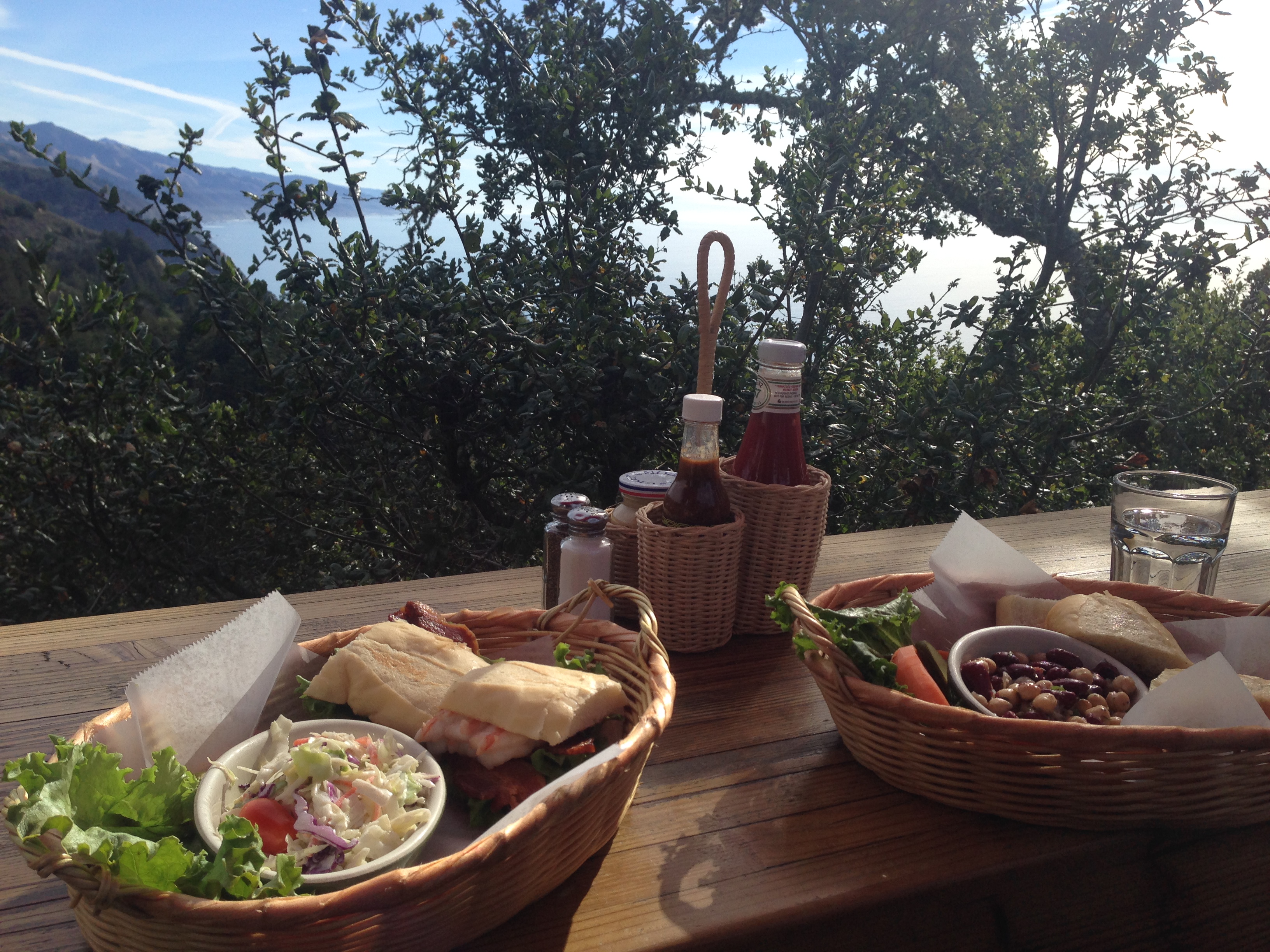
- Pick up some sandwiches from Big Sur Deli and Bazaar and then walk over to Big Sur Bakery (looks like a wood cabin!) and grab some coffee and pastries.
- Drive down the road from Big Sur Deli and Bazaar to Post Ranch Inn, which is a luxury inn with infinity heated pools, provided Lexus cars to drive, morning yoga, star gazing, edible tour of chef’s garden (Wed and Sun at 10:30 AM), and other cool stuff. The Inn houses Sierra Mar Restaurant which has a great ocean view.
- Go to my personal favorite restaurant called Nepenthe. LC told us to go right when the restaurant opens for an early lunch so you don’t have to wait, especially for an outside table. SGDF and I ate our lunch to an amazing view (worth the wait)! They also have a smaller café on the lower deck called “Amphora,” but I would wait for the view.
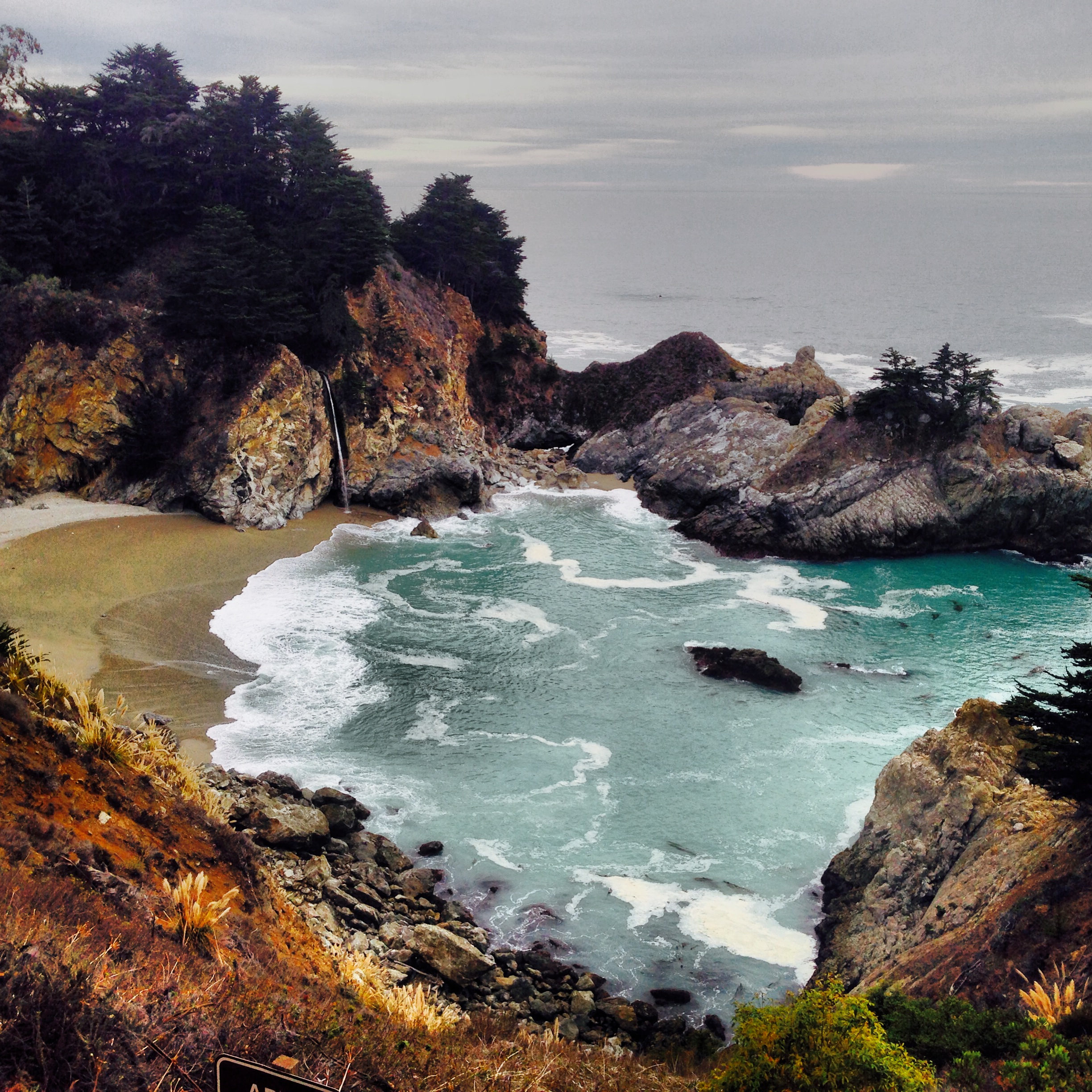
Post lunch: Drive to Parington Cove for a 1-mile hike, 280 feet elevator, and no parking fee. This place was used as a loading point for tanbark around the turn of the 19th century. You walk through the 60 foot tunnel and end up in a secluded cove with the rusty remains of the loading apparatus perched on the rocks. Drive south to my second favorite hiking spot and one of the most famous Big Sur parks, Julia Pfeiffer Burns State Park (4-5 hours). It is open ½ hour before sunrise to ½ hour after sunset. Tip: Free parking right outside the park entrance along the side of the road. There are few hiking trails including the ones below but you should ask a ranger based on skill level / time.
- McWay Waterfall Trail: Easy, 0.6 mile round trip. A quick walk to an overlook facing McWay Falls, an incredible 80-foot waterfall that drops directly onto the sandy beach (only waterfall in California that empties directly into the ocean!) and is accessible via the highway.
- Ewoldsen Trail: Moderate to hard, 4.5 miles roundtrip. A loop trail starting in the redwood forest by McWay Creek and climbing to incredible coastal views and whale watching opportunities. Tip: Pack some lunch and eat while looking at the view below.
Some other attractions: camping but requires reservations and scuba diving – available in the Underwater area.
Evening: Driving further south, the following are along the way:
- Esalen Hot Springs: Normally just open to Institute members, they have public night bathing from 1-3 AM with reservations (link here)
- John Little State Natural Preserves: Preserves steep rugged cliffs and the cabin of Elizabeth K. Livermore, 1917 conversationalist
- Sand Dollar Beach and Jade Cove: Look for jade! Hike! All that good stuff.
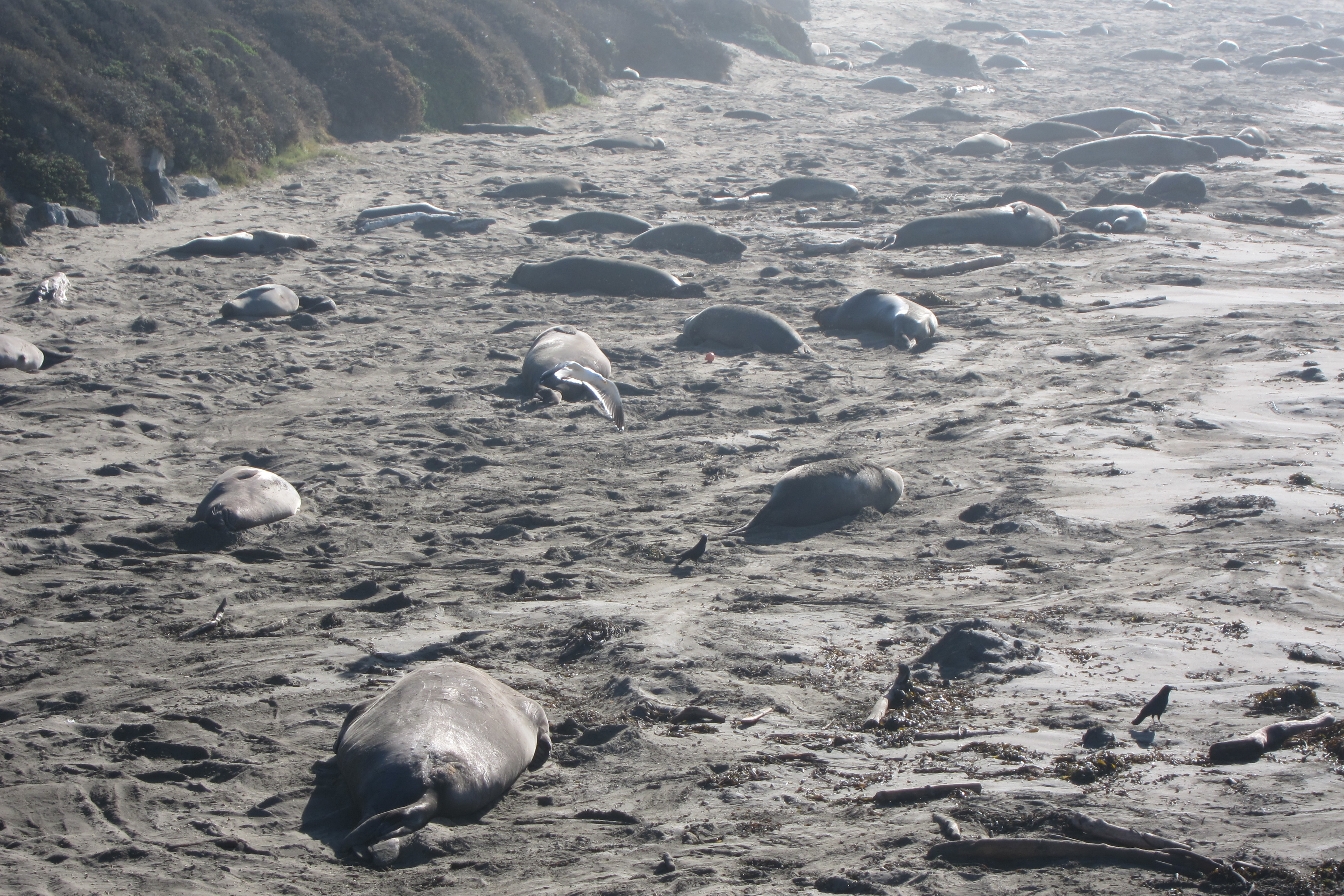
- Piedras Blancas: where A LOT of elephant seals sleep, mate, and fight on the beach and there is also a Light Station that is only accessible via a tour (2 hours, link here)
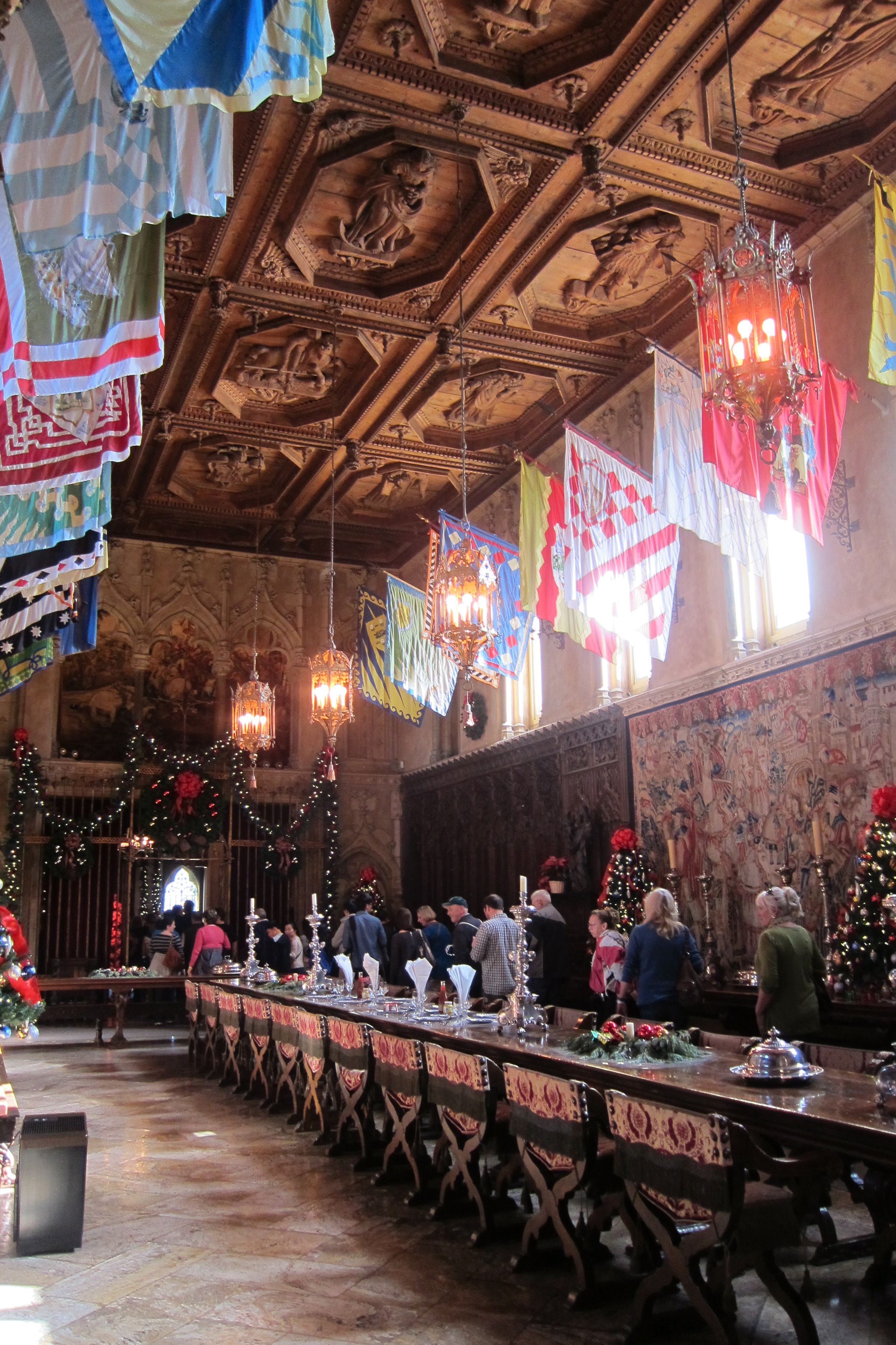
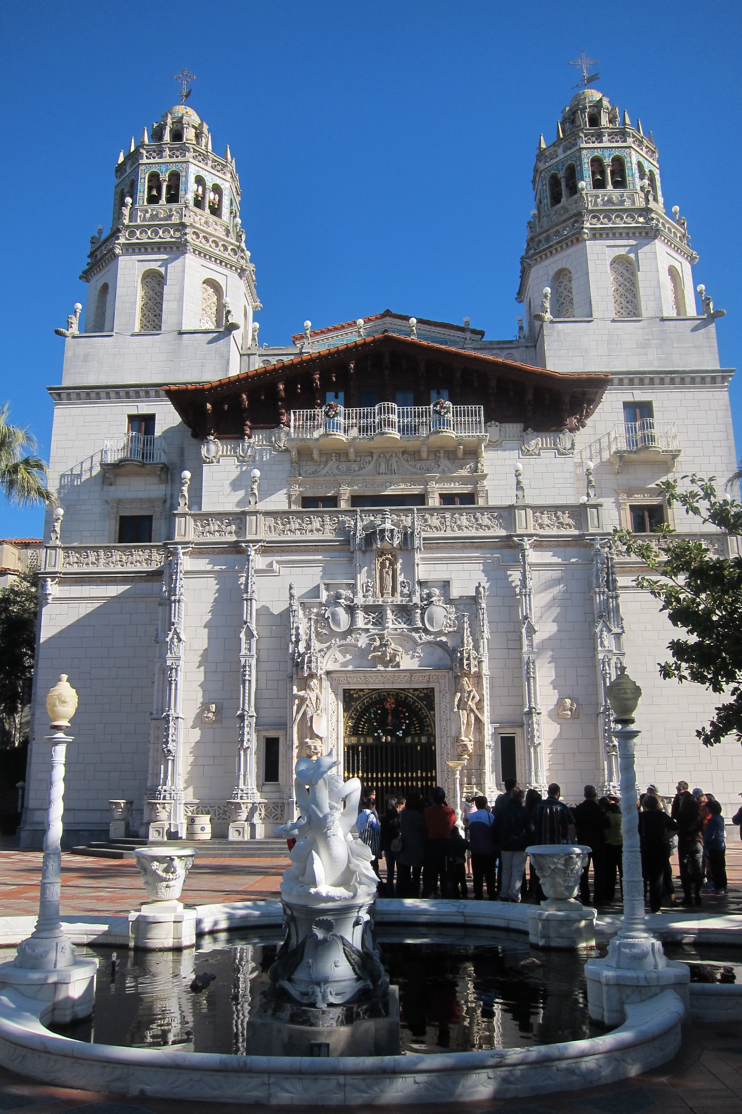
- Hearst Castle (3-4 hours): Will speak to this more later
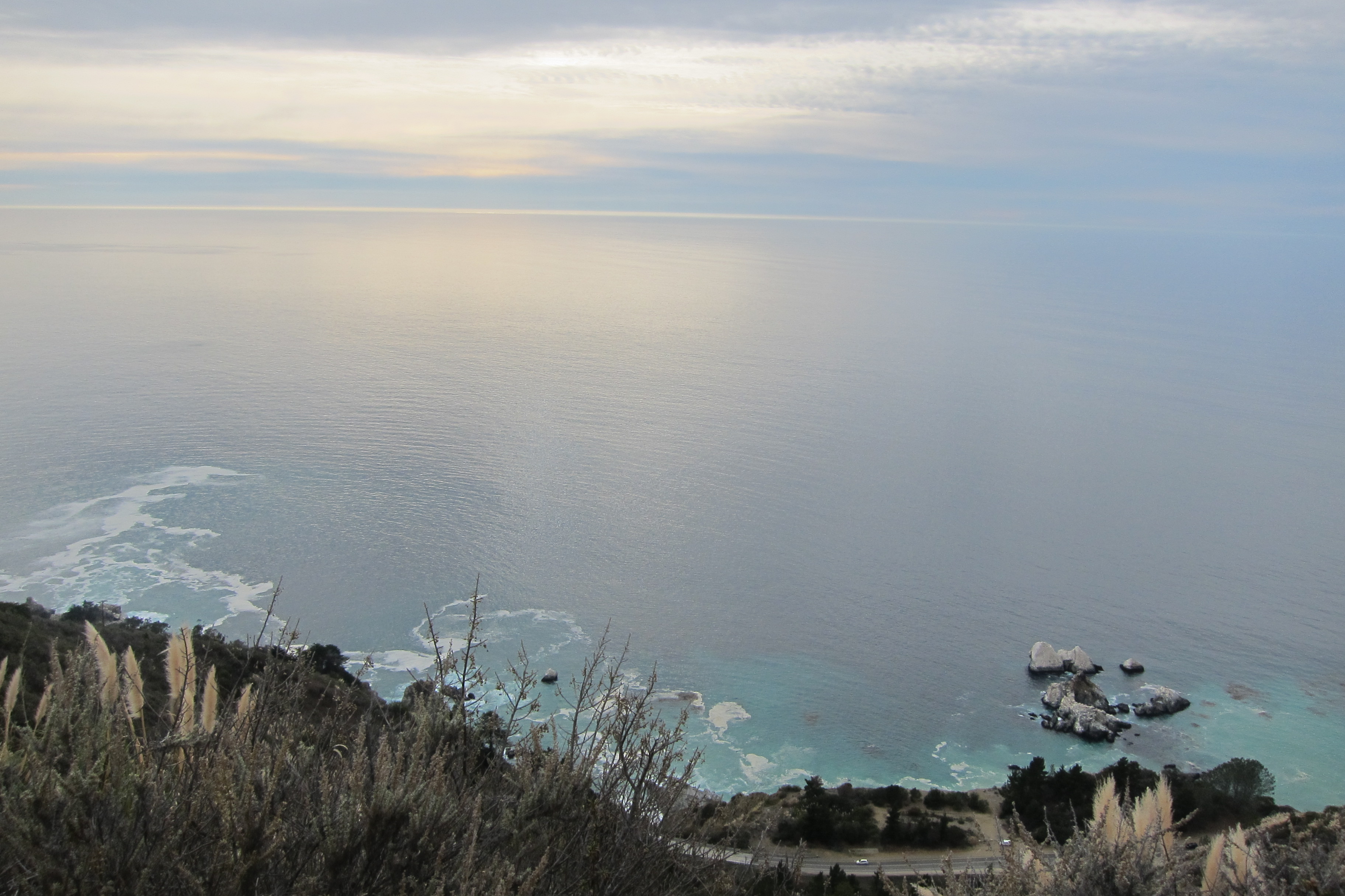
- Take advantage of the stopping areas to check out the amazing views.
Dinner: Head to Linn’s in Cambria and get their potpies and desserts! Everything was delicious and inexpensive. Post dinner, we walked around the town and checked out the small stores and Moonstone Beach.
DAY 3
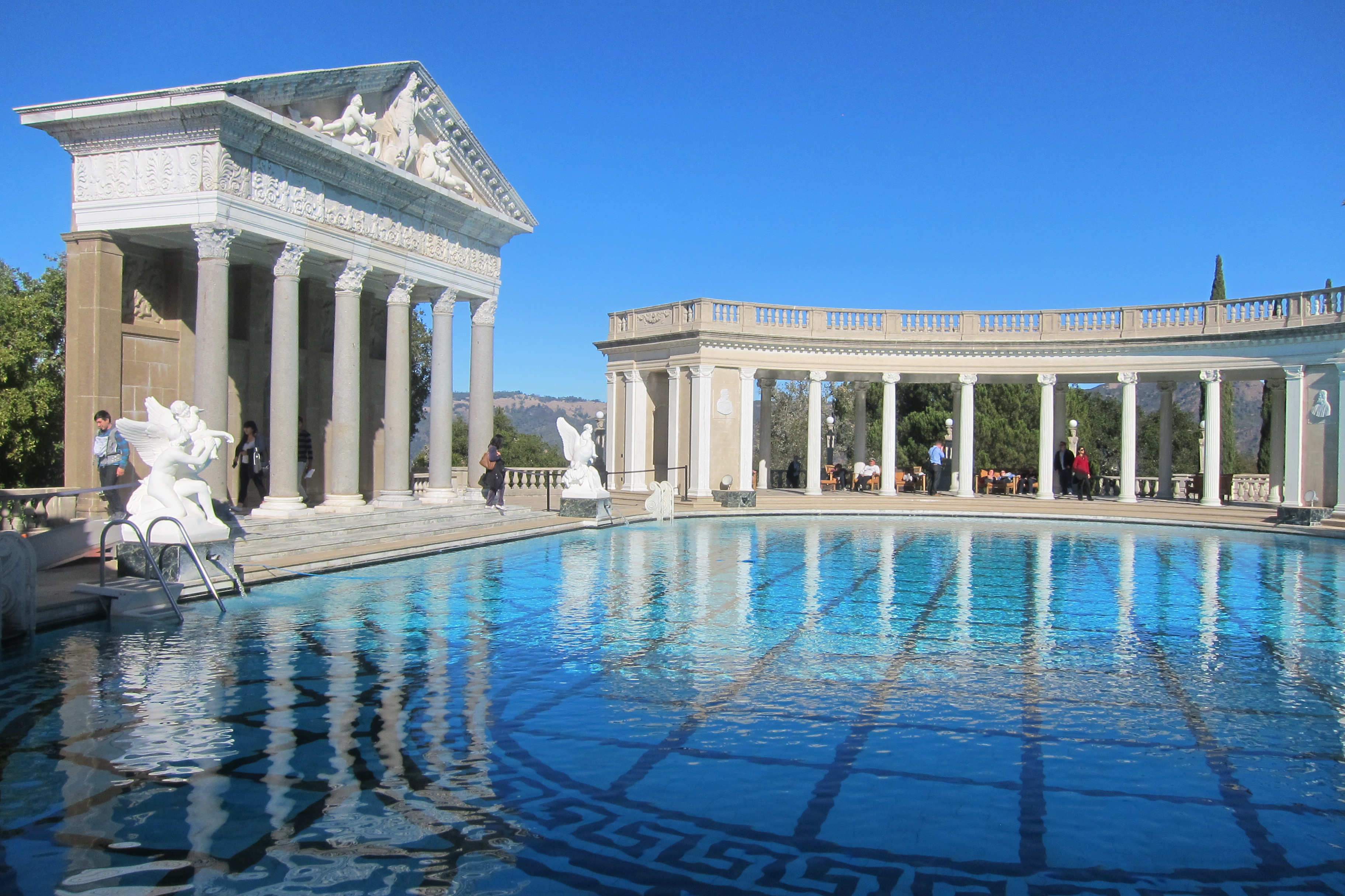
Morning: Grab some coffee or pastries at Linn’s, and then drive back north to Hearst Castle (hopefully reservations were made in advance). There are multiple tours and each tour is ~40 minutes (can take 1 or all of them). Post the tour, SGDF and I wandered the gardens and multiple swimming pools. We loved relaxing by the amazing Roman pools outside. I would love to do the “Evening Tours” in the Spring and Fall that is a bit longer and lets you tour the estate as if you were a guest.

Afternoon: Drive back down south and can stop by the following places:
- Cayucos: Good for fishing perch and sometimes rockfish
- Morro Bay and Rock: An extinct volcanic cone about 23 million years old. There is some great wildlife, blue herons, monarch butterflies, etc.
- City of San Luis Obispo (SLO): Home of Cal Poly State University and the famous Madonna Inn, a unique hotel with over 109 different rooms that range from caveman-style to old English décor and the men’s restroom in the lobby has a waterfall instead of a urinal. Also, they have amazing pies and cakes.
Lunch: In SLO, stop by Firestone Grill for their tri-tip sandwiches. There are a few attractions in SLO like Bubblegum Alley, a narrow passageway where people have been sticking their chewed gum since the 60s, and Mission San Luis Obispo. As you continuing driving down south, stop by Pismo Beach to see coastal dunes and butterfly preserves. If you have time, then you can kayak, surf, and rent ATVs.
Evening: Post Pismo Beach, you end up leaving the 1 Freeway and taking the 101. THere are a few things you can drive to:
- Santa Ynez Valley: There is wine and beer tasting
- Ostrich Land: Can feed ostriches and emus
- Solvang: A Danish-style town completely decked out to look out of a movie and has delicious Danish pastries. I would walk around the town and take pictures of all the quaint buildings.
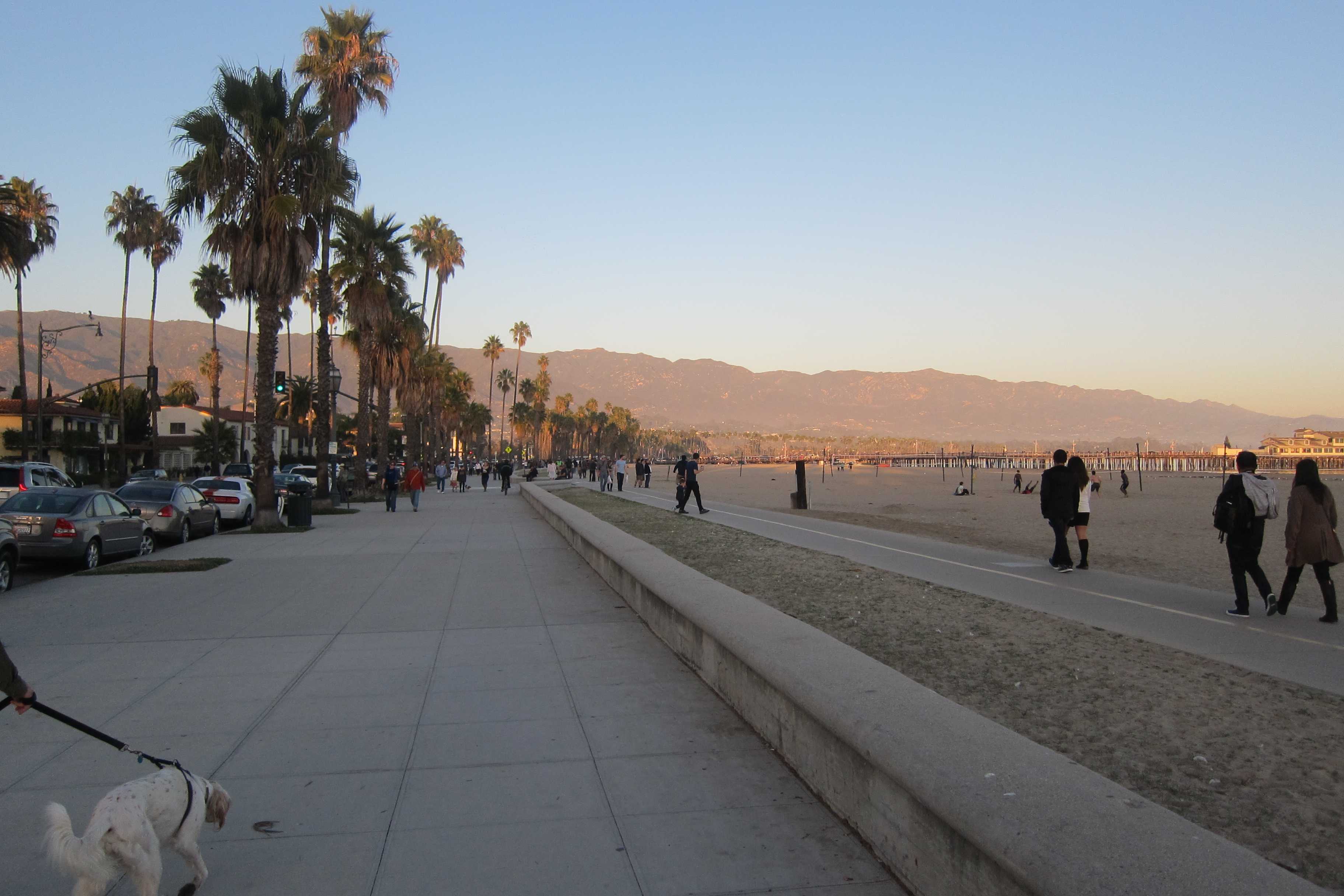
- Santa Barbara: Home to Mission Santa Barbara, considered one of the prettiest missions and is still functioning as a church, Stearns Wharf, can shop and eat, Alice Keck Park Memorial Gardens, wine tasting, and beaches.
- Malibu: North of Los Angeles and great for a coastal hike and eating. Some places to hike include, Point Dume Hike, Escondido Falls, The Grotto, Zuma Canyon Trail, Malibu Creek State Park, and Los Liones.
Dinner: Can either grab dinner in Santa Barbara or Malibu at Malibu Seafood, a seafood shack right off the PCH, but be prepared to wait.
Post dinner: Continue driving south until you hit Los Angeles!
